Call 508-888-6434 for Friendly, Expert Advice
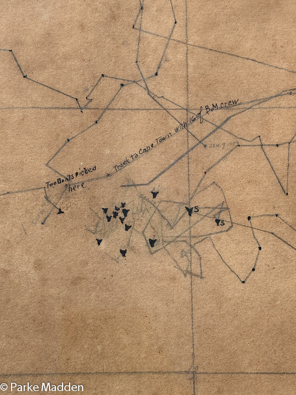
Rare 19th C. Whaling Chart of Bark Canton II Off South Africa
Nantucket Sunrise Birdseye View Map by Bryan & Royster
Antique 1929 Pictorial Map of Nantucket by Walter Holt
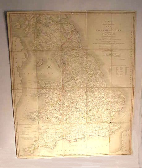
Antique travelling map of British Isles 1828
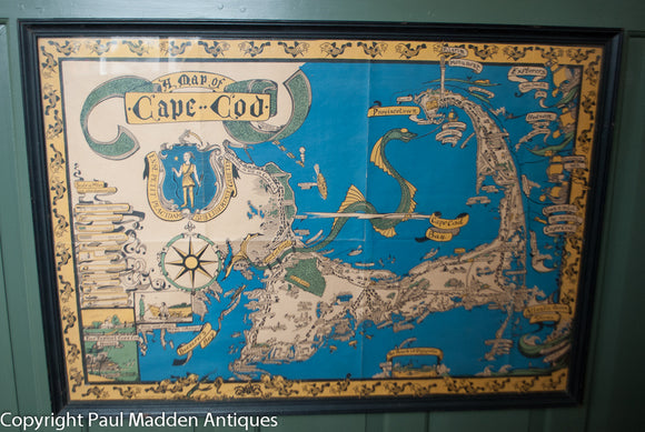
Vintage 1937 Jack Atherton Pictorial Map of Cape Cod
Eldridge's Vineyard Sound Lt. Ship to Chatham Chart 1917
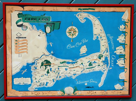
Vintage Pictorial Map of Cape Cod
Vintage Cape Cod by Melanie Elisabeth Leonard
Rare 18th C. Newport Map
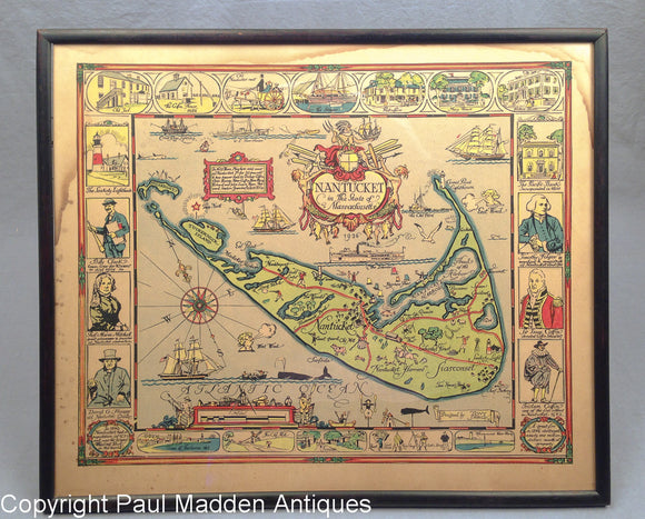
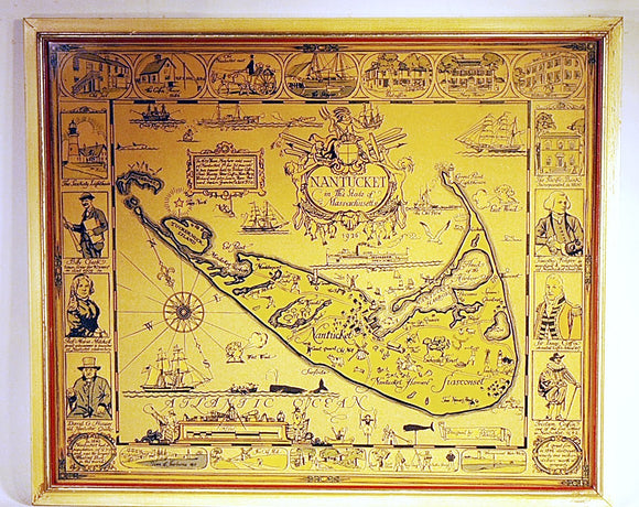
Antique Map of Nantucket by Austin Strong
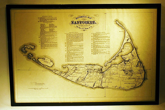
Vintage Map of Nantucket - Ewer Reprint
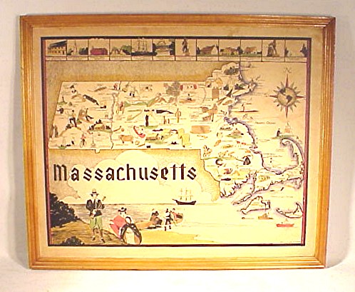
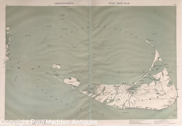
Vintage printed map of Massachusetts circa 1930's.
Vintage Melanie Elisabeth Leonard Map of Cape Cod
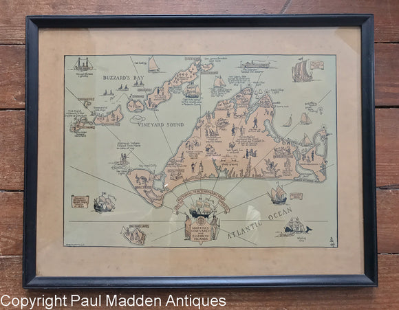
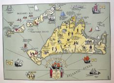
Vintage Martha's Vineyard Map - Tercentenary 1930
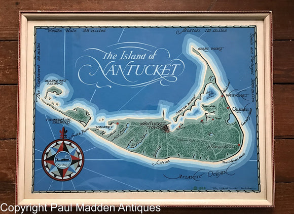
Vintage Map of Nantucket by Roy Clifford Smith 1948
Vintage Map of Admiral Byrd's 2nd Antarctic Exploration
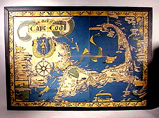
Vintage large size map of CAPE COD
Vintage 1948 Map of Nantucket by Roy Clifford Smith
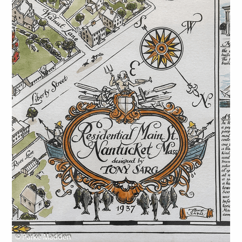
Residential Main Street Nantucket by Tony Sarg 1937
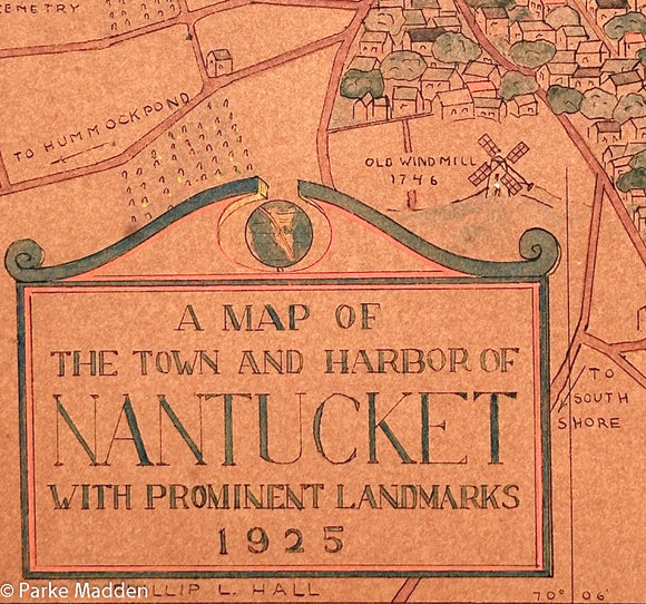
Rare Map of Nantucket Town and Harbor by Phillip L. Hall 1925
Rare antique hand painted MAP OF NEW BEDFORD 1926
Rare 1948 Pictorial Map of Cape Cod by Claretta Pope Higgins
Pair of Vintage Pictorial Maps of Martha's Vineyard & Nantucket by Atherton 1937
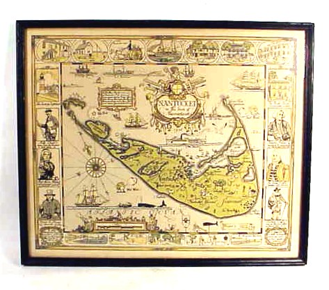
Original Tony Sarg printed map of Nantucket
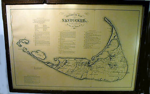
Original 1891 Walker Map of Nantucket
Nantucket Map by Tony Sarg 1926
Martha's Vineyard Tercentenary Map 1930
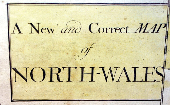
Early 18th Century English map of NORTH WALES
Antique printed map of Cape Cod by Melanie Elizabeth Leonard
Antique Nantucket map by TONY SARG 1926
Antique Nantucket map by Ewer
Please wait...